
Sugar Beach Sherbourne Common

Sugar Beach and Sherbourne Common: A Modern Waterfront with Industrial Views
61 Dockside Drive
Queens Quay looking east from Freeland Street, Toronto, between 1980 and 1998. Courtesy of the City of Toronto Archives.
Corner of Sherbourne St. and Queens Quay, looking South, Toronto, 1972. Courtesy of the City of Toronto Archives.
“Light Showers” by Jill Anholt, Sherbourne Common, Toronto, 2011. Image by Stephen Allen. Licensed via a Creative Commons Attribution-Share Alike 3.0 Unported license.
Canada’s Sugar Beach, Toronto, May 24, 2021.
Important Work
Both Canada’s Sugar Beach and Sherbourne Common show how nature, contemporary design, and recreation combine to create a new relationship with the waterfront. This area is similar to Eberhard Zeidler’s vision for public use of the lakefront when planning Ontario Place in the late 1960s. While the site is not directly connected to these two parks, here we can see how the ideas of the late twentieth century have spread. Both offer Torontonians a space to relax among greenery, surrounded by modern glass architecture, including George Brown College’s waterfront campus and Corus Quay, headquarters of Corus Entertainment.
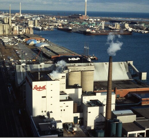
Claude Cormier + Associés, the designers of Canada’s Sugar Beach, set out to create an urban oasis, inspired by the beaches set up next to the river Seine in Paris and the painting Bathers at Asnières by Georges Seurat. Influenced by the nearby Redpath Sugar Refinery, the park’s features are inspired by candy. The large granite boulders at the park have candy cane stripes, and the umbrellas on the beach are bubble-gum pink. Planners made every effort to ensure the park is always a happy place.
The Men of the Trees
Completed in 2011, Sherbourne Common is a space for fun and relaxation. Its design shows one way to effectively turn a formerly industrial area into an environmentally friendly green space, a place that celebrates the relationship between the city and the natural environment. The park’s pavilion, powered by renewable energy, sits above a stormwater treatment facility that uses a chemical-free ultraviolet system to purify water before returning it to Lake Ontario. The park’s centrepiece is the “Light Showers” installation created by artist Jill Anholt, who explores the connection between natural and human-made spaces through her work. Purified water flows through this fountain-like sculpture as it makes its way to the lake.
Sherbourne Common’s eco-friendly solution to returning clean water to the lake is a noted contrast to previous decades of water management in Toronto. The eastern end of Toronto’s harbour was a highly polluted area by the middle of the 20th century. By the late 1950s, the nearby Don River was so contaminated that, when Princess Margaret visited in 1958, a rumour spread that city officials dumped perfume in the water to keep her from smelling the river’s bad odour. Historian Jennifer Bonnell writes that Toronto’s rivers were “little more than open sewers” in the 1950s and this pollution often spread to Lake Ontario. The pollution was so severe, several Torontonians held a funeral ceremony for the Don River in 1969.
Lest we Forget
Sherbourne Common’s shoreline provides a great view of Toronto’s Port Lands area to the east. This once heavily industrial district sits on a large portion of what was once an extensive wetlands area known as Ashbridge’s Bay Marsh. Home to many species of plants and wildlife, the marsh covered over 1,200 acres. In 1912, the Toronto Harbour Commission initiated its plan to fill in much of the marsh area to create space for industry. Into the 1930s, workers made new land by first building dock walls, using pine trees reinforced with cement, then filling the space with sand and clay taken from the lakebed. The project progressed quickly, and workers had already completed a sizeable portion of the Port Lands by 1916. This land, which the commission later named the “Toronto Harbour Industrial District”, is still primarily used for industrial activity.
Workers used a massive dredging machine to move sediment from the bottom of Lake Ontario and create an industrial landscape. In their 1912 plan, commissioners estimated that the new industrial district would require 27,000,000 yards of earth. They planned for the new shore to rise eight feet above the average water line. Planners shipped additional soil into the area from outside Toronto to help achieve this height. However, the amount of industry they ended up attracting to the area fell well below expectations. Regardless, the completion of the Port Lands forever changed the shape of Toronto’s harbour.
It’s up to us…
Toronto city planners started to rethink the use of the city’s lakefront in 1967. They wrote a new plan for the area, emphasizing the need for more parks to bring Torontonians back to the shoreline. Since then, there have been several lakefront development ideas. One, abandoned due to the COVID-19 pandemic, was the Sidewalk Labs’ development of Quayside, just to the east of Sherbourne Common. The company — part of Google’s Alphabet Inc. — was chosen by Waterfront Toronto in 2017 to develop a mixed-use neighbourhood in the area. Sidewalk Labs wanted to build homes, including affordable housing, offices, stores, and several community buildings. There would be a “vibrant streetscape” and several cutting-edge features, including heated pavement, underground delivery tunnels, green roofs (rooftops covered in vegetation), and even vacuum-like pipes to carry away the trash.
The project was controversial, as Sidewalk Labs intended to fill the neighbourhood with sensors that would collect a wide variety of data, including weather trends, foot traffic, household energy use, and garbage disposal habits. Many Torontonians expressed concerns about the project over privacy: how the data collected by Sidewalk Labs would be used. Although Sidewalk Labs abandoned the project in 2020, attempts to develop Quayside continue.
Dig deeper…
For more about the history of the Don River, see:
Jennifer L. Bonnell. Reclaiming the Don: An Environmental History of Toronto’s Don Rover Valley. University of Toronto Press: 2014.
See the CBC footage of the funeral held for the Don River in 1969.